Luangwa District
This article needs additional information. |
| Luangwa District | |
|---|---|
| District | |
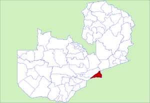
 District location in Zambia | |
| Country | |
| Province | Lusaka Province |
| Capital | Luangwa |
| Population (2000) | |
| • Total | 18,948 |
| Time zone | CAT (UTC+2) |
Luangwa District is a district of Zambia, located in Lusaka Province. As of the 2000 Zambian Census, the district had a population of 18,948 people.[1]
Not far from the Bush Bag Bush Camp flows the Chongwe River, which empties into the Zambezi River at the district's border with Zimbabwe. Further up the Zambezi's course is Chikwenga Island. The Zambezi River also forms the border between the Luangwa District and Mozambique. Along this stretch of the river is the village of Kapoche. On a small peninsula that juts out into the Zambezi River, close to the intersection of Zambia, Mozambique, and Zimbabwe and where the draining stream of Lake Cahora Bassa flows into the Zambezi, is the capital, Luangwa. In the town of Luangwa, one of Zambia's roads, D145 which is now tarred, terminates at an intersection of three smaller roads contained entirely within Luangwa. Within the Luangwa District, D145 goes north through Kapoche, Katondwe, Nchinkwo, Mwavi, Luwinga, Kasinsa, before crossing into the larger Chongwe District. This mostly forested district includes multiple hills, including Nyamuzino Hill.
References
<templatestyles src="Reflist/styles.css" />
- ↑ Lua error in ...ribunto/includes/engines/LuaCommon/lualib/mwInit.lua at line 23: bad argument #1 to 'old_ipairs' (table expected, got nil).